Earthquakes in Turkey, Syria prompt UN to activate emergency satellite mapping
The United Nations activated its emergency mapping satellite service in the wake of the horrific earthquakes that devastated Turkey and Syria on Monday.
More than 5,300 people were reported dead as of Tuesday, with the death toll from the disasters expected to rise.
The magnitude 7.8 earthquake struck west of Gaziantep, Turkey, at 1:17 a.m. UTC, with another quake of magnitude 7.5 hitting the region just a few hours later.
“The International Federation of Red Cross and Red Crescent Societies (IFRC) activated the United Nations Satellite Centre (UNOSAT)’s Emergency Mapping service over both Syria and Turkey,” the United Nations Institute for Training and Research (UNITAR) said in a release. “UNOSAT triggered the International Charter: Space and Major Disasters to collect satellite images of Syria.”
RESCUERS SEARCH FOR SURVIVORS IN TURKEY, SYRIA AFTER EARTHQUAKE LEAVES MORE THAN 5,000 DEAD

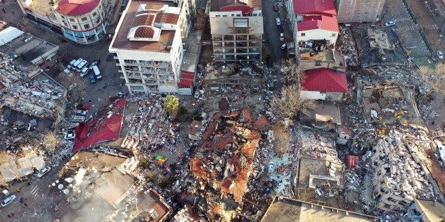
An aerial view of collapsed buildings after earthquakes hit Kahramanmaras, Turkey, on Feb. 7, 2023. ((Photo by Evrim Aydin/Anadolu Agency via Getty Images))
According to UNITAR, since 2003, the emergency mapping service has provided “satellite image analysis during humanitarian emergencies related to disasters, complex emergencies and conflict situations.”
The live web map publishes preliminary geophysical data from seismological centers.

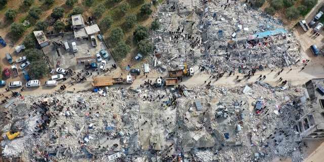
This aerial view shows residents helped by bulldozers, searching for victims and survivors in the rubble of collapsed buildings, following an earthquake in the town of Sarmada in the countryside of the northwestern Syrian Idlib province, early on Feb. 6, 2023. ((Photo by MUHAMMAD HAJ KADOUR / AFP) (Photo by MUHAMMAD HAJ KADOUR/AFP via Getty Images))
UNOSAT supports U.N. member states with satellite imagery analysis over their territories and provides training and capacity development in the use of geospatial information technologies, on the basis of voluntary contributions.
TURKEY HIT WITH 7.8 MAGNITUDE EARTHQUAKE, FELT ACROSS MIDDLE EAST

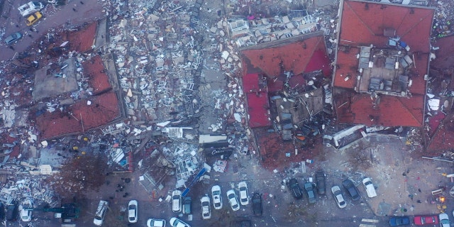
An aerial view of collapsed buildings in Kahramanmaras, Turkey, on Feb. 7, 2023. ((Photo by Ä°zzet Mazi/Anadolu Agency via Getty Images))
The center does not operate its own satellites and no U.N. organization has satellites of its own, according to the Norwegian Space Agency.
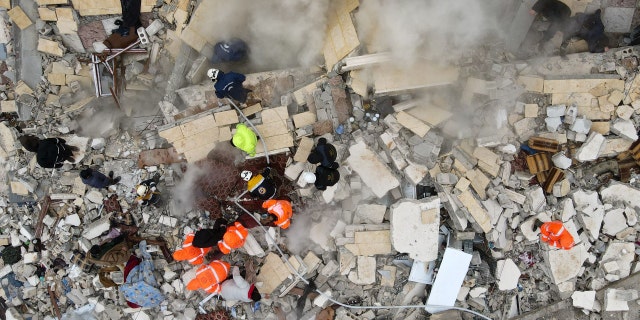
Search teams and emergency aid from around the world worked to aid rescue efforts in Turkey and Syria on Tuesday.

This aerial view shows residents searching for victims and survivors amidst the rubble of collapsed buildings following an earthquake in the village of Besnia near the town of Harim, in Syria’s rebel-held northwestern Idlib province on the border with Turkey, on Feb. 6, 2022. ((Photo by Omar HAJ KADOUR / AFP) (Photo by OMAR HAJ KADOUR/AFP via Getty Images))
The damage has spread over a wide area, however, and voices that had been crying out from rubble in towns have fallen silent.
CLICK HERE TO GET THE FOX NEWS APP
“We could hear their voices, they were calling for help,” Ali Silo, whose two relatives could not be saved in the Turkish town of Nurdagi, told The Associated Press.
The Associated Press contributed to this report.
Stay connected with us on social media platform for instant update click here to join our Twitter, & Facebook We are now on Telegram. Click here to join our channel (@TechiUpdate) and stay updated with the latest Technology headlines. For all the latest Technology News Click Here
